

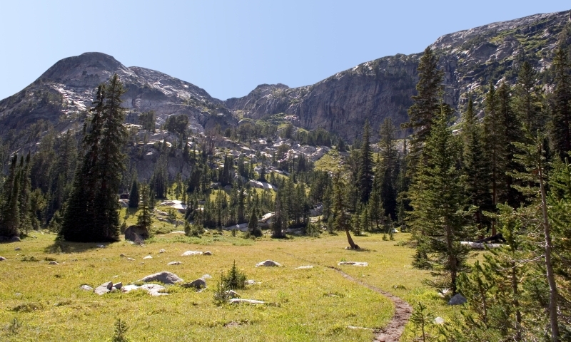


Clarks Fork District of the Shoshone National Forest
The Clarks Fork Ranger District includes the Beartooth Loop trail - a designated National Recreation Trail.
CRANDALL AREA
Closed Creek #607.2:
Length (miles): 6.0
Level of Use: Light
Difficulty: Difficult
Elevation Change: 7,000-8,000
Trailhead, Access and Other Information: Access via Crandall Trail (located S of Crandall Ranger Station on WY Hwy. 296). Horse facilities available at North Crandall Trailhead.
Papoose Trail #607.2B :
Length (miles): 12.0
Level of Use: Light
Difficulty: Moderate
Elevation Change: 7,200-10,800
Trailhead, Access and Other Information: Access via 1) Crandall Trail (located S of Crandall Ranger Station on WY Hwy. 296)--travel along Crandall Trail approx. 7 mi. to intersection. 2) Alternate trailhead--North Crandall Trailhead (WY 296 W of Crandall Creek bridge.) Enters along Yellowstone NP via Bootjack Gap/Upper Miller Creek.
North Crandall Trail:
Length (miles): 16.0
Level of Use: Light
Difficulty: Moderate
Elevation Change: 6,200-10,000
Trailhead, Access and Other Information: Located just off WY Hwy. 296, 1/4 mi. W of Crandall Creek bridge 1pma1 Crandall RS. Tremendous views of Hurricane Mesa and North Crandall drainage. Travels into along Yellowstone NP/Cache Creek (not maintained).
Crandall Trail #611:
Length (miles): 17.5
Level of Use: Light
Difficulty: Moderate
Elevation Change: 6,200-10,000
Trailhead, Access and Other Information: Located S of Crandall RS 1pma1 E of Crandall Creek on WY Hwy. 296. Alternate access - N Crandall Trailhead. Travels into along Yellowstone NP via Timber Creek* and connects w/ Upper Miller Creek Trail. *Dangerous talus slope -extreme caution w/ horses.
BEARTOOTH AREA
Crazy Lakes #612.1:
Length (miles): 6.0
Level of Use: Moderate
Difficulty: Easy
Elevation Change: 7,000-8,300
Trailhead, Access and Other Information: Access directly across from Crazy Creek Campground - 10 MI E of Cooke City, MT on US 212.
Night Lake #620:
Length (miles): 5.0
Level of Use: Heavy
Difficulty: Easy
Elevation Change: 9,300-9,700
Trailhead, Access and Other Information: Access at Island Lake Campground - 27 MI E of Cooke City, MT on US 212.
Beauty Lake #621:
Length (miles): 2.5
Level of Use: Light
Difficulty: More Difficult
Elevation Change: 9,200-9,700
Trailhead, Access and Other Information: Access via 1) Night Lake Trail--intersects after 2.7 mi. or 2) Beartooth Trail #619--intersects after 1/2 mi.
Beartooth Loop National
Recreation Trail:
Length (miles): 14.4
Level of Use: Moderate
Difficulty: Easy
Elevation Change: 8,900-10,500
Trailhead, Access and Other Information: Access: Travel 38 MI W of Red Lodge, MT on US 212 or Recreation Trail 16.5 MI NW of Cody, WY on WY Hwy. 120 to Sunlight Basin Road--51 MI to US 212 junction. Continue E on US 212 to one of the following trailheads: 1) HAUSER LAKE TRAILHEAD - located along Beartooth Hwy. N of Hauser Lake. 2) Gardner Lake Trailhead - located along Beartooth Hwy. above Gardner Lake. 3) Dollar Lake Trailhead - accessible by 4WD or motorbikes; located at Dollar Lake.
Dead Indian/Sunlight Basin Area
Elk Creek Trail #602:
Length (miles): 11.0
Level of Use: Light
Difficulty: More Difficult
Elevation Change: 6,000-8,400
Trailhead, Access and Other Information: Access: WY 120 NW of Cody, WY to Sunlight Basin Rd--follow for 21 MI to signed trailhead. Junction w/ Dead Indian Meadows Trail. Not recommended for pack animals.
Dead Indian Trail #761:
Level of Use: Light
Difficulty: Moderate
Elevation Change: 6,000-8,200
Trailhead, Access and Other Information: Trailhead across from Dead Indian Campground on WY Hwy. #296. Follows Dead Indian Creek to Dead Indian Meadows. Ends several miles short of headwaters.
For more information, contact:
Shoshone National Forest
Phone: 307-527-6241